There is a point in the first three miles where the forest closes in around you and you stop thinking about the summit. The switchbacks are long and the grade is manageable and you could be hiking anywhere in the Coconino. Then the trees thin, the wind picks up, and the switchbacks get short and steep, and you remember where you are going. Humphreys Peak is the highest point in Arizona. Getting there from the Snowbowl trailhead is a full day’s work.
Overview
Humphreys Peak Trail No. 151 begins at Arizona Snowbowl at 9,340 feet and climbs to the summit through two distinct worlds: a long forested approach through old-growth conifers and aspen groves, and an exposed alpine ridge above treeline where the trail becomes a series of wooden posts and cairns across open tundra. The round trip is a full day for most hikers. Afternoon lightning is a serious hazard in summer and monsoon season. The window for safe, enjoyable hiking is late June through October, with September and early October being the best weeks on this mountain.
Arizona’s Highest Ground
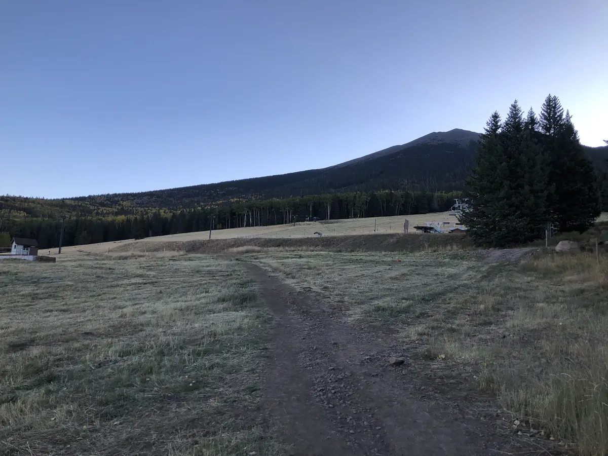
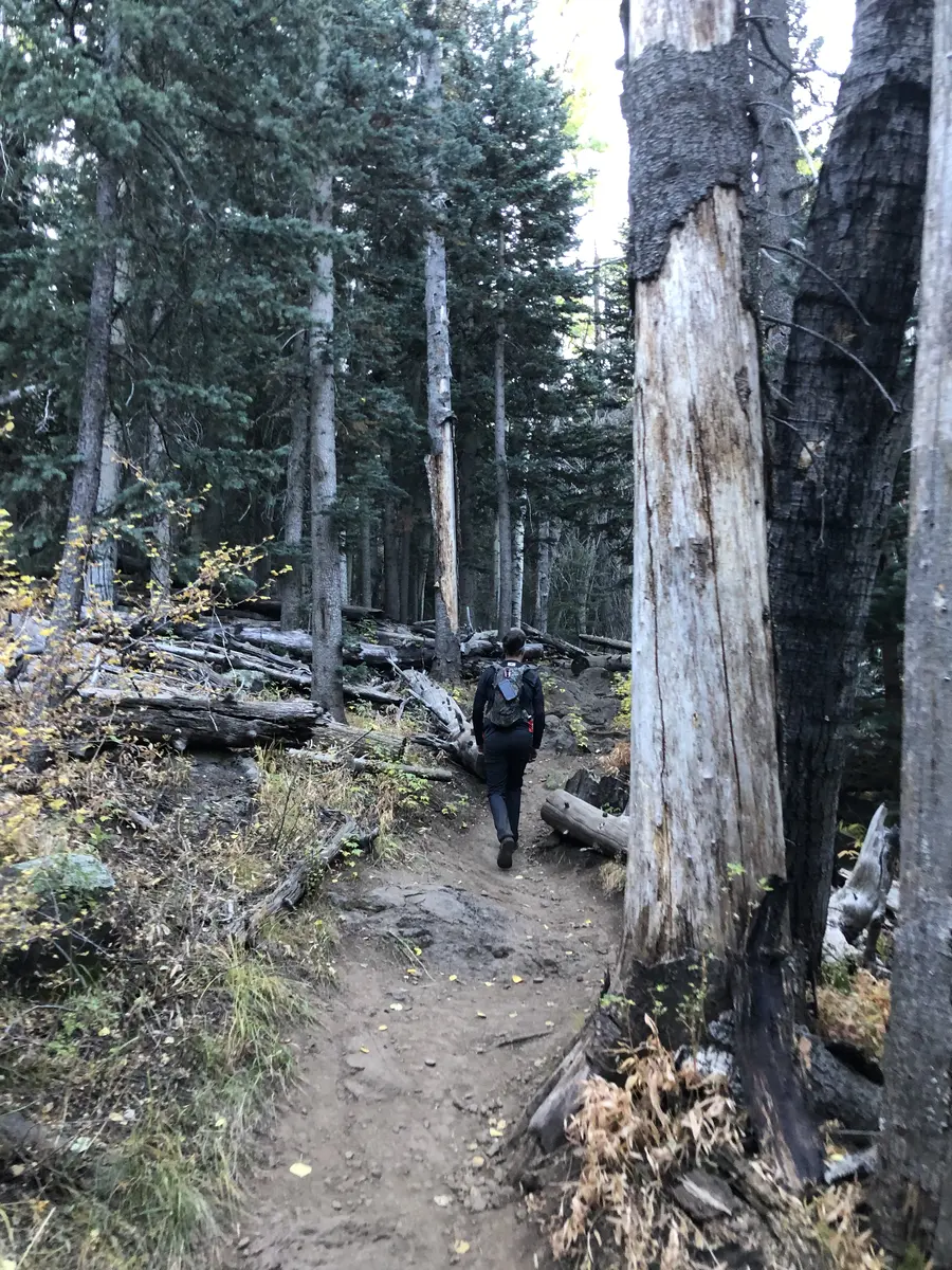
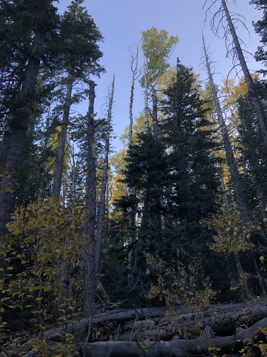
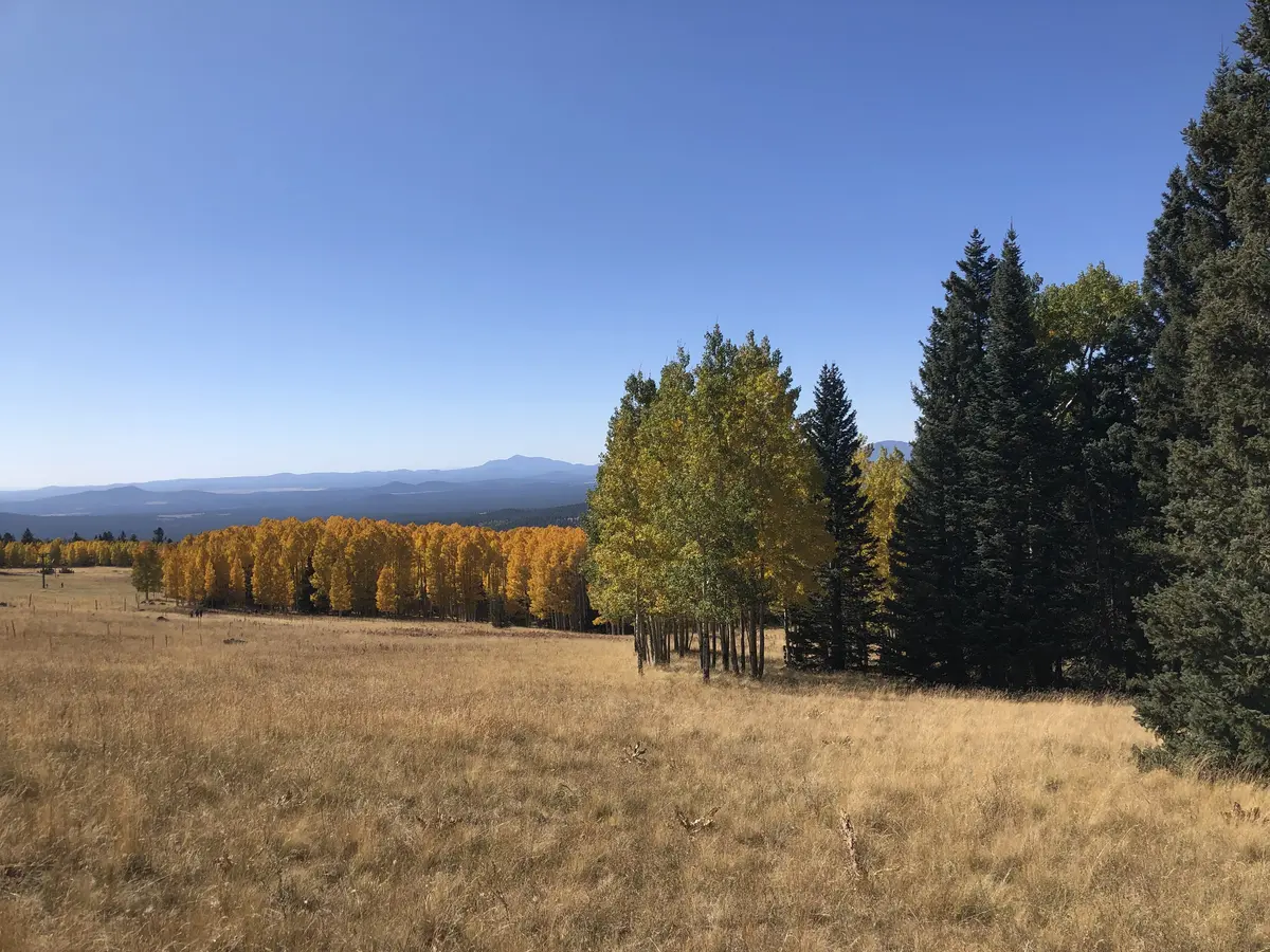
The trail starts at the northeast corner of the Snowbowl parking lot and crosses an open meadow, passing under a ski lift before entering the trees. A sign marks the Kachina Peaks Wilderness boundary a short distance in. From here to about mile 3, the trail is a series of long switchbacks through mixed conifer forest: spruce, fir, pine, and in the lower sections, aspen. The grade is steady. If you did not start early enough, this is where you will start feeling the altitude.
Around mile 1, there is a trail register on the left. Stay left at the junction just beyond it — the right fork leads to the ski lodge and is not your route. At 2.3 miles there is a broad boulder field that looks like a reasonable shortcut across the switchback. It is not. Turn right onto the next switchback and stay on trail.
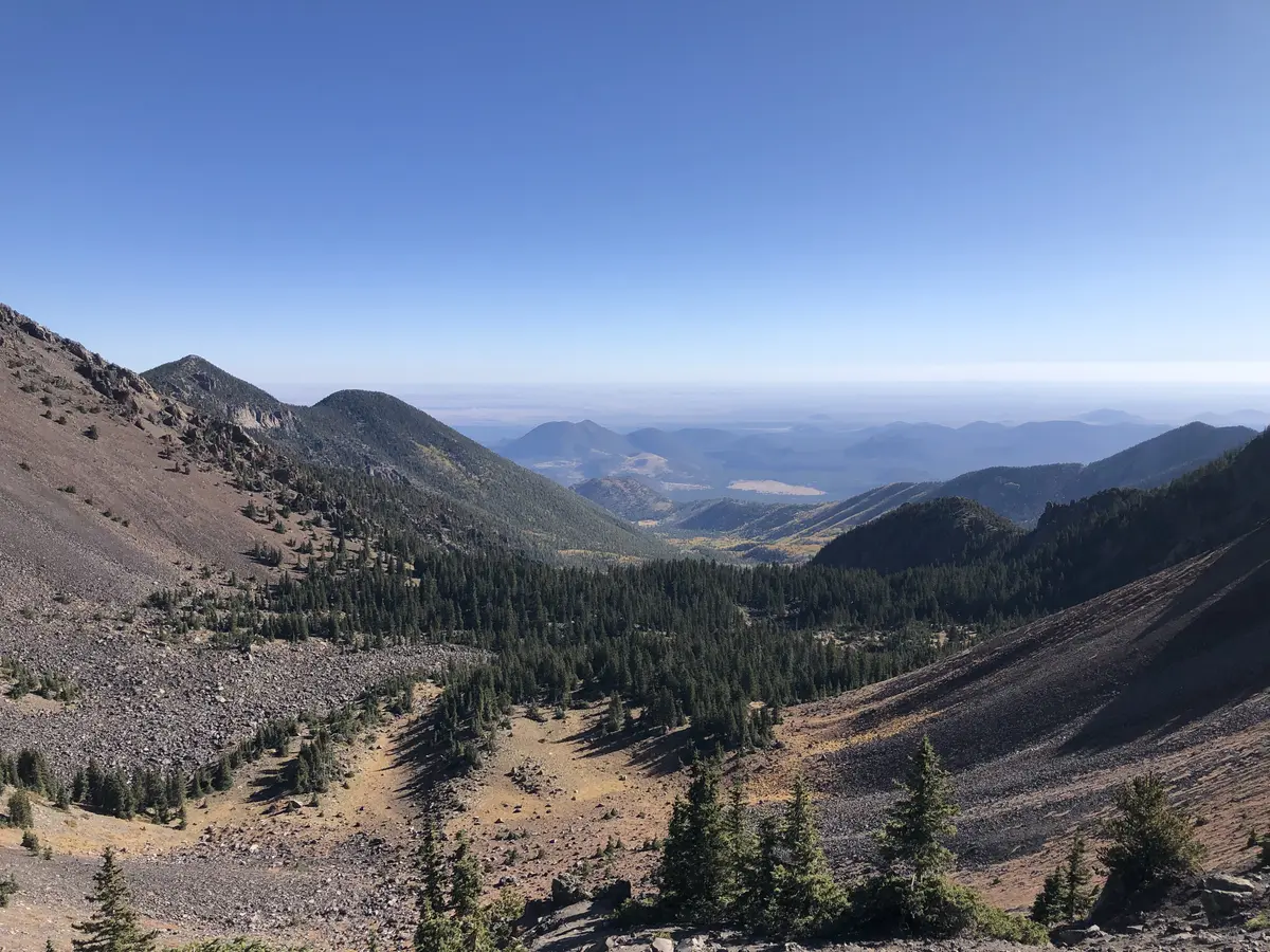
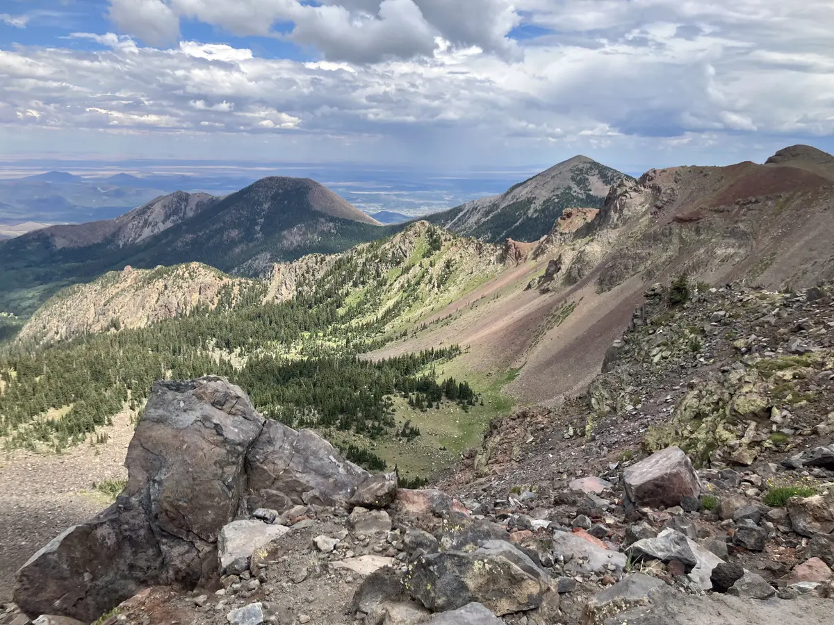
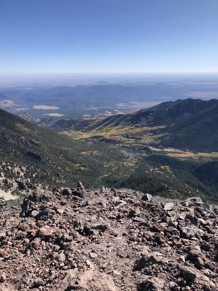
Views of Agassiz Peak, the next summit south on the ridge, open up around mile 3. The switchbacks get shorter and steeper. At roughly 11,400 feet a sign marks the alpine zone and warns against going off trail or camping above this point. The ecosystem up here is fragile and slow to recover. The trail is asking you to pay attention.
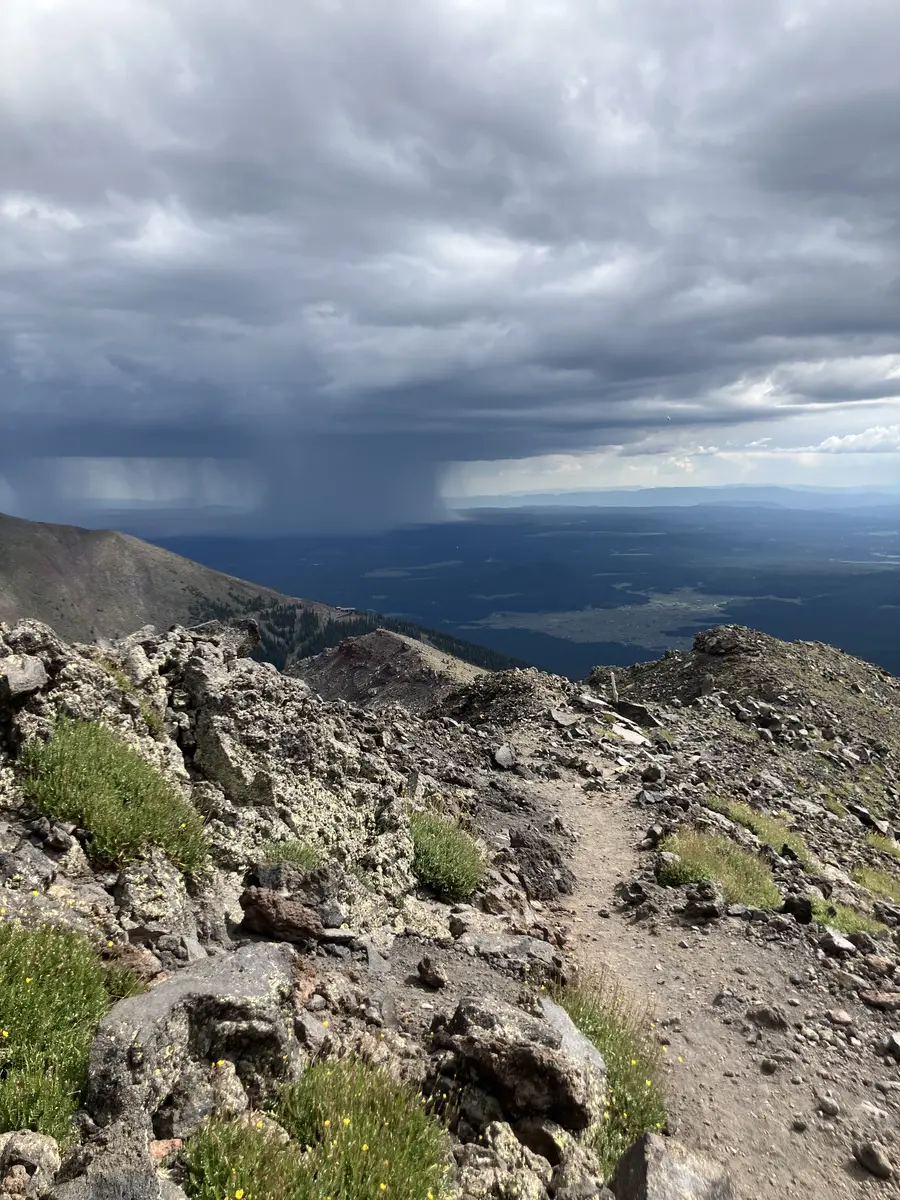
The saddle sits at about 11,700 feet, a little past the four-mile mark. There is a trail junction at the saddle. Go left, up the ridge. The right fork drops into the Inner Basin and is not the summit route. From the saddle you can see into the back bowl of the Kachina Peaks Wilderness on one side and the Flagstaff valley on the other. This is the right place to assess the weather. If storms are building to the southwest, this is also the right place to turn around.
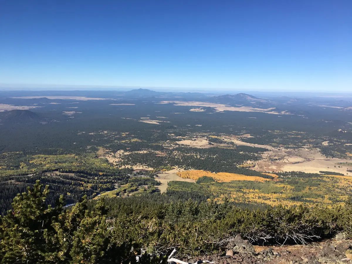
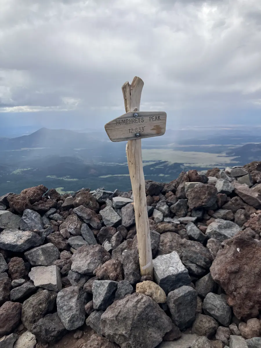
The final mile from the saddle to the summit is the most exposed section of the trail. Bristlecone pines give way to open tundra. Wooden posts mark the route at intervals but the path is not always obvious underfoot. There are multiple false summits on the ridge and each one looks like it could be the last. They are not. Stay left and follow the posts. The wind up here can be genuinely forceful. The summit is marked by a wooden sign. On a clear day you can see the Grand Canyon to the north, Oak Creek Canyon to the south, and the desert flats running west toward Williams.
The descent is the same route back. Above the saddle, stay focused — route-finding on the ridge going down is easier to miss than on the way up. Below the saddle, the long switchbacks back through the forest feel longer than they did on the way up.
Timing & Crowds
Late June through October. September and early October are the best weeks: temperatures are cool, the aspens are turning, and the monsoon has mostly wound down. July and August are hikeable but require starting at or before sunrise to clear the exposed ridge well before afternoon storms develop. The trail is open year-round; winter adds avalanche risk on the upper slopes and requires a free backcountry permit from the Flagstaff Ranger District.
This is one of the most popular hikes in Arizona. It is part of the Arizona Six Pack of Peaks challenge and draws consistent crowds on fall weekends. The Snowbowl parking lot fills early. If you want a quieter day, weekday mornings in September are the move. Fall weekends are busy from the parking lot to the summit.
Getting There
The trailhead is at Arizona Snowbowl, 14.5 miles northwest of downtown Flagstaff. Take US Highway 180 north for 7 miles, then turn right onto Snowbowl Road (Forest Road 516) and drive 7.4 miles to the resort. The trail begins at the northeast corner of the lower parking lot. Restrooms are available at the resort.
No fee and no permit required for day hiking. Dogs must be leashed. Contact the Flagstaff Ranger Station at 928-526-0866 for current conditions.
What to Bring & Safety
Water first. There is no water on this trail and no source at the trailhead. Three liters is a reasonable minimum for a cool day. Altitude and dry air will dehydrate you faster than you expect.
Layers matter more here than on any Phoenix-area trail. The summit can be 30 degrees colder than the parking lot, and wind chill on the exposed ridge adds to that. Bring a wind shell at minimum. A heavier layer if you are hiking in spring or fall.
Lightning is the most serious objective hazard on this trail. The rule most experienced hikers follow here is to be off the exposed ridge and below treeline by noon in summer and early fall. If you see storms building while you are on the ridge, turn around. This is not a soft warning. People have been struck on this mountain.
Trekking poles help significantly on the descent through the long forest switchbacks and on the rocky sections above treeline. This is not a technical climb, but the final ridge is uneven terrain and the altitude is real. Start early, carry enough water, and watch the weather.