You can see it from the highway before you even turn off. Picketpost Mountain rises flat-topped and abrupt out of the desert east of Superior, a butte that looks exactly like what it is: something difficult to get on top of. The mountain has been visible from US-60 to every driver heading between Phoenix and Globe for decades. The trailhead is twenty minutes off the freeway. Getting to the summit is a different conversation.
Overview
Picketpost Mountain Trail begins on a flat stretch of the Arizona Trail, turns sharply uphill at about half a mile, and does not relent until the summit plateau at 4,375 feet. The approach is manageable. The upper section is Class 3 scrambling up loose, steep rock guided by painted arrows and cairns. Route-finding is a genuine challenge throughout the upper trail. Download a GPS track before you go — this is one of the few Phoenix-area hikes where that is not optional advice.
The View Earns the Climb
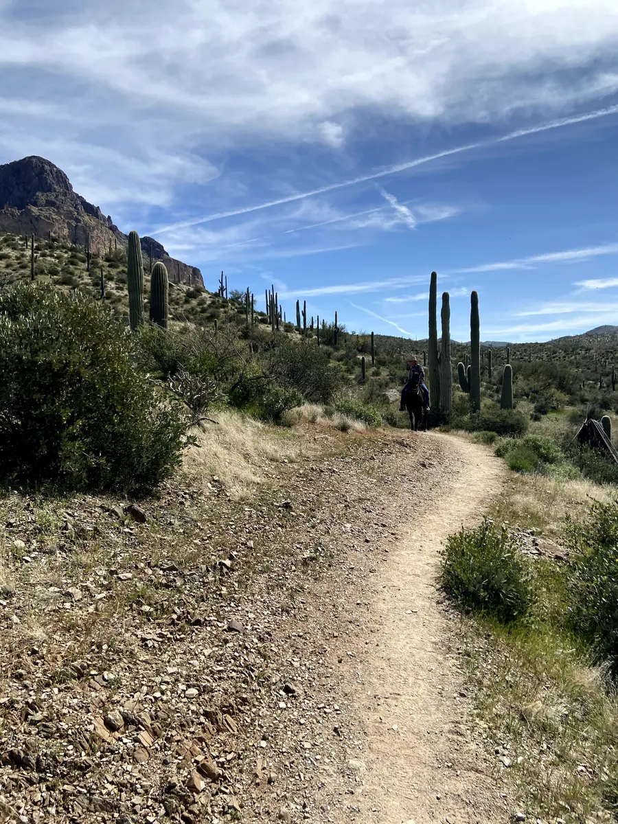
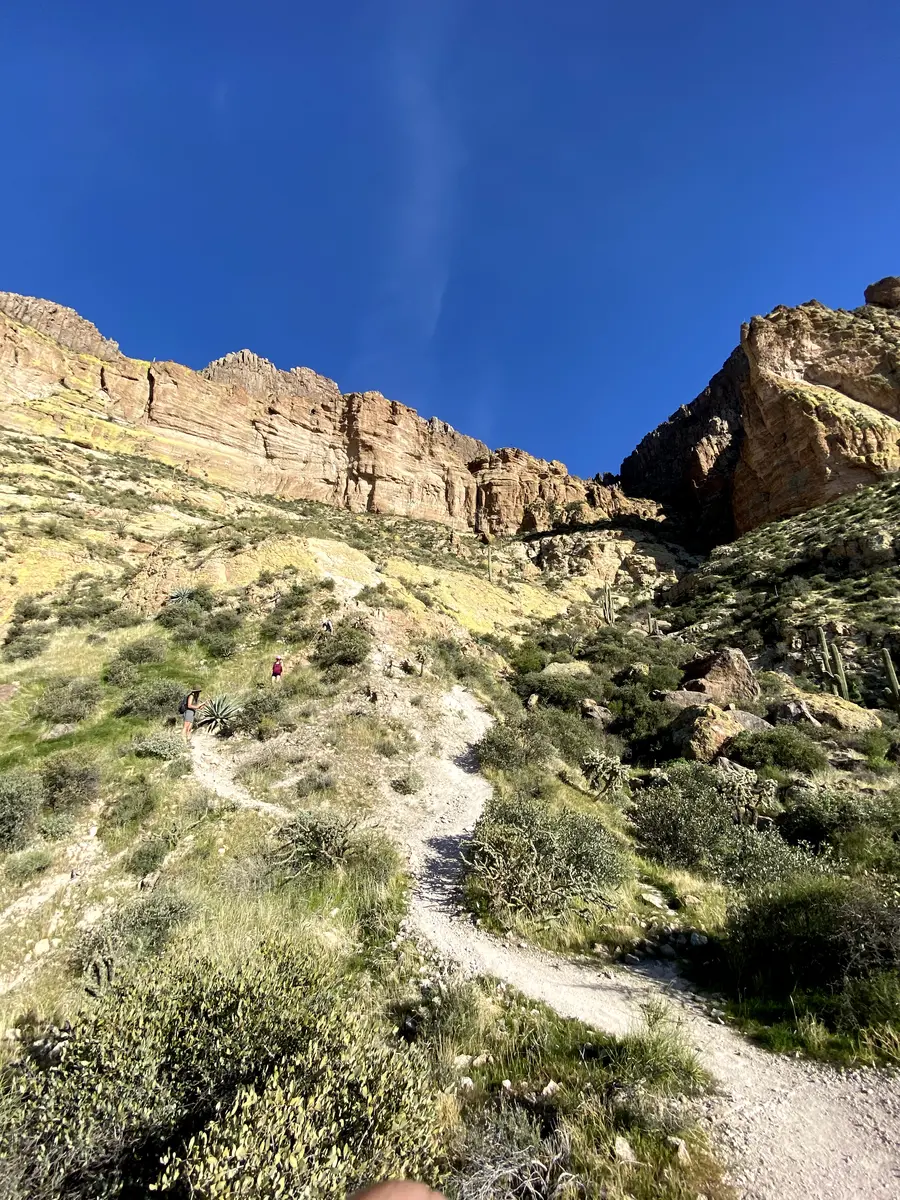
The trail starts at the Picket Post Trailhead off US-60, heading south on the Arizona Trail through flat Sonoran desert. The path here is wide, well-defined, and shared with horses and mountain bikers. Saguaro cacti frame the approach and the mountain looms directly ahead, getting larger and steeper looking with every step.
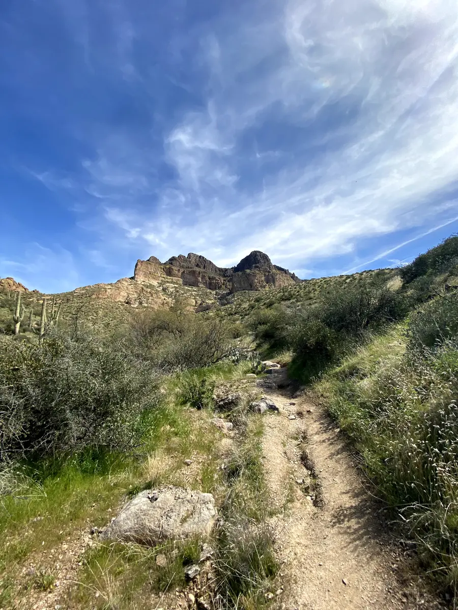
At roughly half a mile, the trail splits. Watch for a spray-painted arrow on the rock and signage for the Picketpost Mountain Trail. This is the junction most people miss or second-guess — downloading the route beforehand takes the uncertainty out of it. Turn off the Arizona Trail here and head toward the mountain.
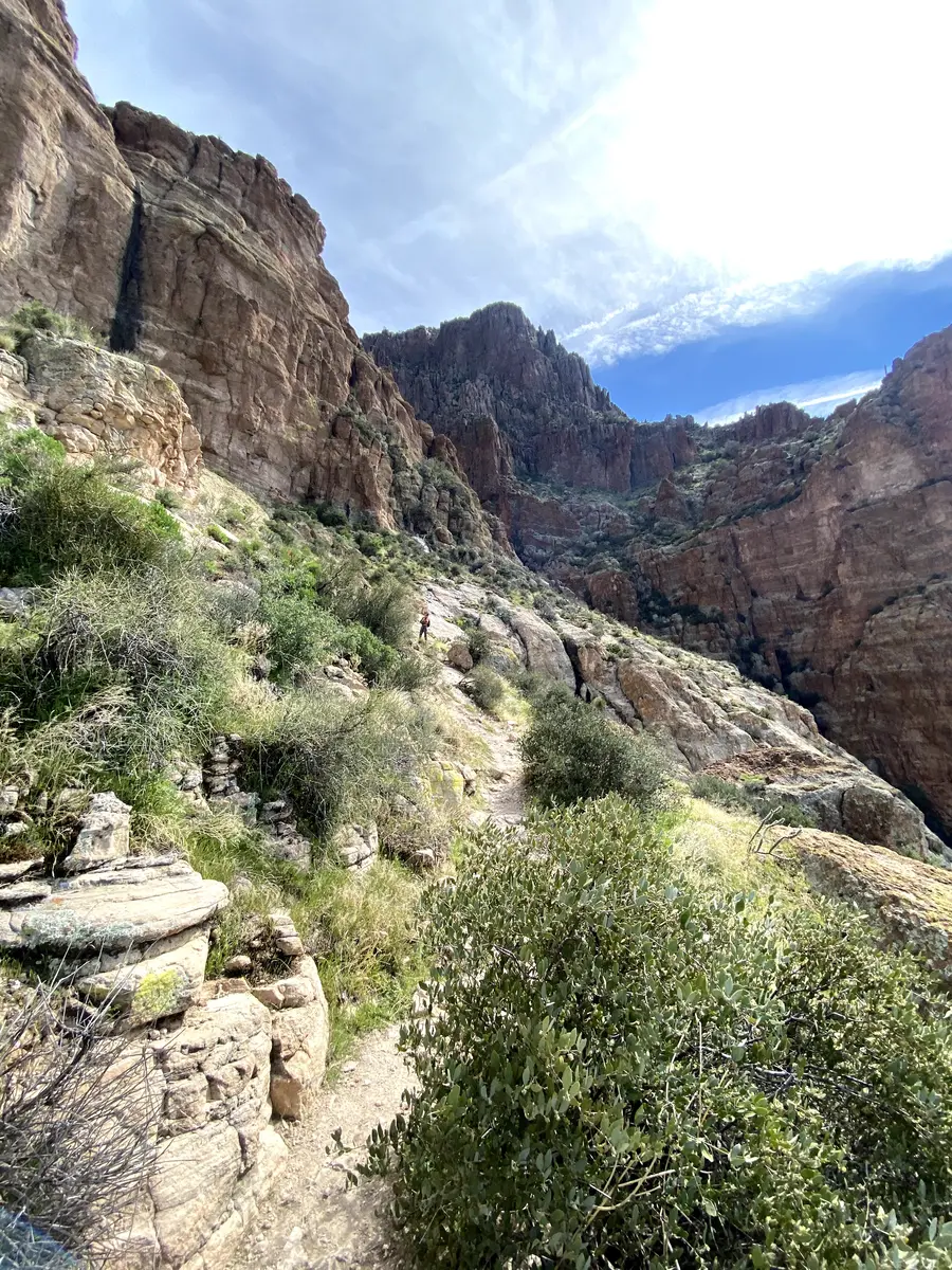
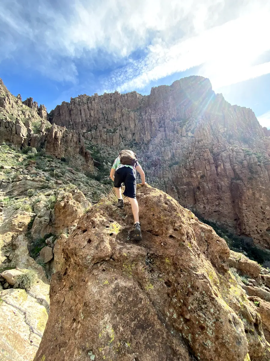
Above the junction, the trail becomes a different thing. Painted markers — white dots, red arrows, occasional cairns — replace the obvious corridor. Multiple social trails intersect the correct line. The grade steepens steadily. Around 1.4 miles the scrambling begins in earnest: hands on rock, feet finding purchase, moving through steep chutes and over loose boulders. Stay left of the main ravine on the approach to the upper section. The rock is volcanic and rough enough for grip but loose enough to demand attention on every step.
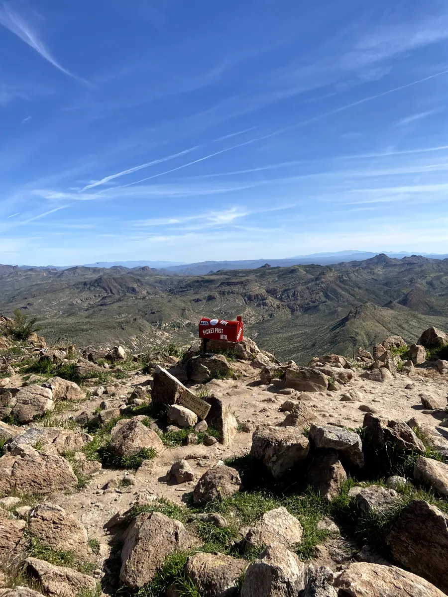
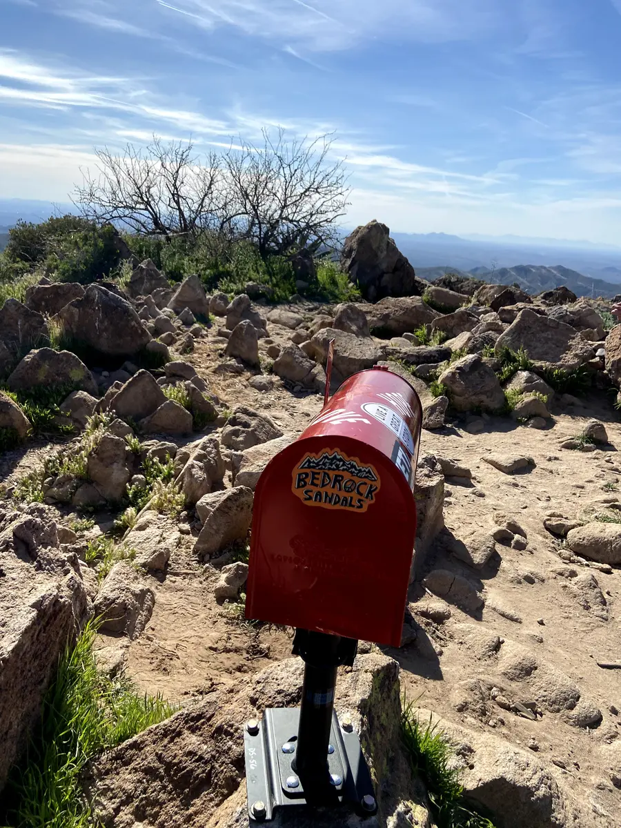
The terrain flattens briefly as you reach a wide basin area near the top. Many hikers stop here thinking they have summited. They have not. Continue straight across the plateau toward the true high point, which is marked by a wooden post and the summit mailbox. Inside the box: logbooks going back decades, notes from other hikers, stickers, small items left as trail tradition. It is worth a few minutes at the top before the descent.
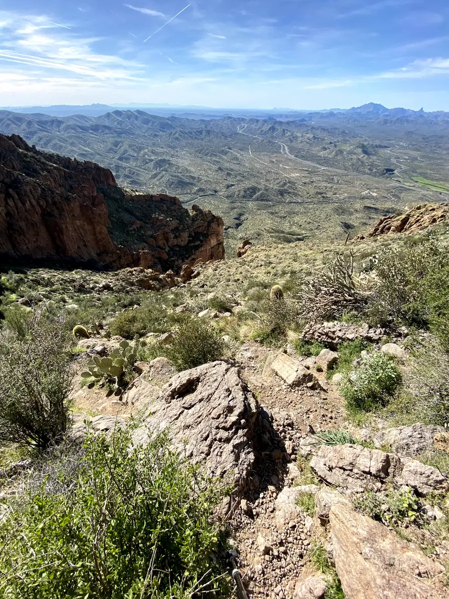
The views from the summit are wide. The Superstition Mountains fill the horizon to the north. The Phoenix metro spreads west. On a clear day the Santa Catalinas are visible to the south. The desert below looks as flat as a map.
The descent is where the route-finding is hardest. The painted markers are easier to follow going up than going down, and the multiple trails through the upper section can pull you off route quickly. Keep your GPS active on the way down.
Timing & Crowds
November through March. The trail is fully exposed and climbs nearly 2,000 feet without shade. Summer is not viable regardless of start time. In fall and spring, a pre-dawn start matters — the upper scramble faces the sun directly and heats up fast.
Picketpost is a well-known Phoenix day trip and a popular entry in the Arizona Six Pack of Peaks challenge. The parking lot fills early on weekends in season. Arrive before 7am if you want a spot without circling. Weekday mornings are significantly quieter. The scramble section naturally filters the crowd — the summit is less congested than the trailhead suggests.
Getting There
The Picket Post Trailhead is on US-60 east of Superior, between mile markers 221 and 222. From Phoenix, take US-60 east approximately 60 miles. Turn south on Forest Road 231 for 0.3 miles, then right on Forest Road 310 for another 0.7 miles to the trailhead parking area. The lot has restrooms and interpretive signage. No fee and no permit required.
Overnight parking is allowed but camping is not permitted at the trailhead.
What to Bring & Safety
Water is the first priority. There is no water on the trail or at the trailhead. Two to three liters is the minimum for a cool day; more in any warmth. The climb is sustained and the upper section is physically demanding.
Footwear matters above the junction. The rock on the upper section is loose and steep. Trail runners with aggressive tread work. Approach shoes or stiff hiking boots work better. Do not attempt the upper scramble in casual footwear.
Trekking poles help on the lower section but are a liability on the scramble — you will want both hands free. Consider leaving them at the junction or packing them before the technical terrain begins.
Download a GPS track before leaving the car. This is one of the few Phoenix-area trails where navigation is a legitimate challenge in both directions. The painted markers are enough to follow on the way up if you are paying attention. On the way down, they are easier to miss.