All Hikes
View all Arizona hikes → PhoenixSedonaTucsonFlagstaff Grand CanyonSaguaroPetrified ForestSuperstition Wilderness

View all Utah hikes → MoabSt. GeorgeSalt Lake City ZionBryce CanyonArchesCanyonlands

View all Colorado hikes → Denver AreaColorado SpringsTelluride Rocky Mountain NPMesa VerdeBlack Canyon

View all California hikes → Eastern SierraSan DiegoBay Area Joshua TreeYosemiteDeath ValleySequoia

View all New Mexico hikes → AlbuquerqueSanta FeTaos White SandsCarlsbad CavernsSandia Mountains

About

Camelback Mountain - Echo Canyon Trail

Phoenix's most famous and most crowded mountain hike, a genuine physical test with a summit view that earns it, if you can get past the parking lot circus.

2.46 mi.Distance
+1,312 ft.Elevation
1.5 - 3.0 hrs.Est. time
5.4/10Our Rating
NoDogs
FreeFees

Our Ratings

How we rate trails

🏔️
Scenery Views, landscape variety, and visual payoff. Does the trail deliver something worth the effort?
🥾
Trail Quality Surface condition, signage, and how well-maintained the route is. A high score means you can focus on the hike instead of the logistics.
🌿
Solitude Crowd levels and the realistic chance of finding a quiet moment. One of the most honest scores we give — popular trails pay for their scenery here.
🚗
Accessibility Parking, trailhead amenities, and how easy the trail is to access for someone visiting the area for the first time.
🦅
Wildlife & Nature Flora, fauna, and ecological interest beyond the view. Trails with rich desert or alpine ecosystems score well here.

Each category rated 1–10. Overall score is the average.

🏔️ Scenery
6
🥾 Trail Quality
8
🌿 Solitude
1
🚗 Accessibility
10
🦅 Wildlife & Nature
2
Overall Score 5.4/10

Difficulty

How we score difficulty

Scored from elevation gain per mile and technical terrain. A trail with scrambling or route-finding gets a higher score than pure grade alone. Hard trails are not necessarily better trails.

1-2 Very Easy Flat, short, well-maintained
3-4 Moderate Some elevation, clear trail
5-6 Challenging Sustained climb, rough surface
7-8 Strenuous Steep, technical, some exposure
9-10 Extreme Scrambling, route-finding, serious commitment
7 /10
Strenuous

Steep, technical, some exposure

Getting There

Echo Canyon Trailhead

If you have spent any time in Phoenix, you have seen Camelback Mountain. It rises out of the middle of the city between Scottsdale and Paradise Valley, unmistakable against the skyline. Everyone talks about it. At some point, you go.

Echo Canyon is the northwest face, the shorter side than the Cholla Trail on the opposite side and significantly more technical. Most people who say Camelback is harder than Piestewa are thinking about Echo Canyon.

The Quick Version

2.4 miles round trip, 1,312 feet of gain. The first half is a steep, rocky climb. The second half involves genuine boulder scrambling with pipe handrails bolted into the rock face. There is no shade. Plan on 1.5 to 3 hours depending on your fitness and how long you spend at the summit. Bring more water than you think you need and start early.

What Kind of Trail Is This

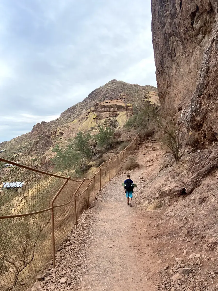
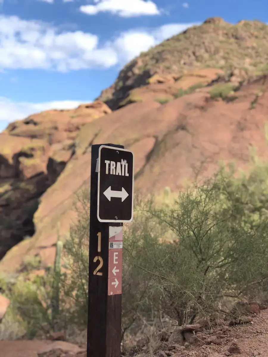
Echo Canyon starts at the parking lot and wastes no time. The first section follows a rerouted path from 2014 that climbs steadily along the natural contours of the mountain. The footing is good here, the views to the east open up quickly, and it is the last easy thing about the trail.

The character changes at the first saddle. The route turns right and follows a massive undercut wall where the rock creates a narrow microhabitat , you will notice the vegetation is different here, cooler and damper than anything else on the mountain. It does not last long.

After the saddle comes what most people remember: two consecutive steep slopes with pipe handrails. The first is the harder of the two. Then a steep gully, short but requiring hands and feet. Then a section of loose gravel that regulars call the Ball Bearings, where every step you take feels like you are working twice as hard. The trail does not level out again until you are on top.

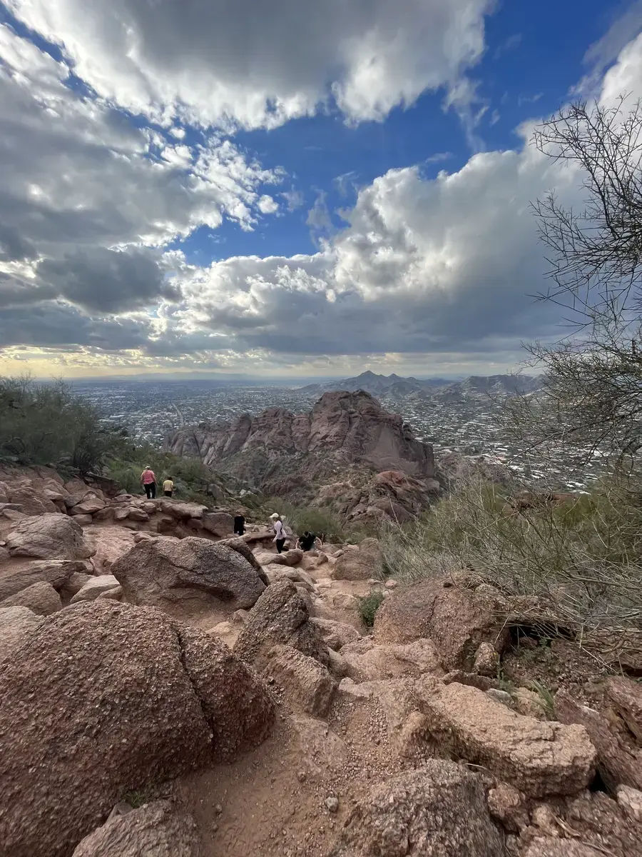
The upper section near the summit is less defined. The trail dissolves into boulders and you are essentially route-finding on your own. There are usually enough other hikers that you can see where people are going, but it is not obvious. A few moves require pulling yourself up with your hands.

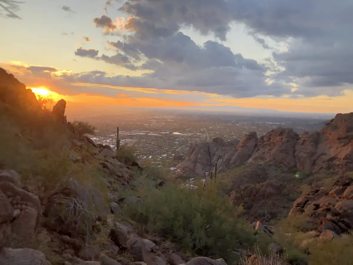
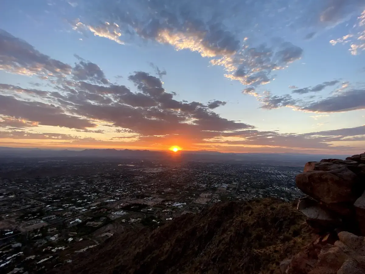
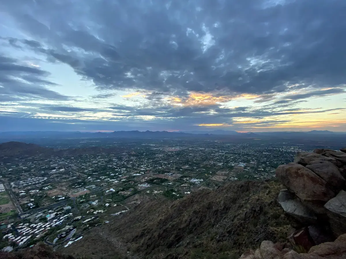
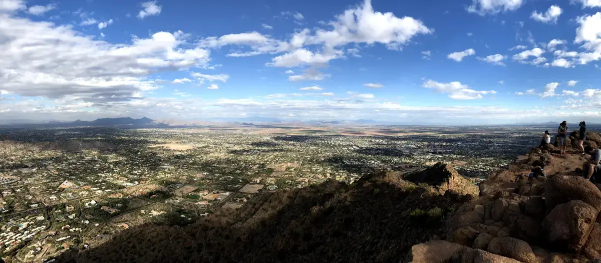
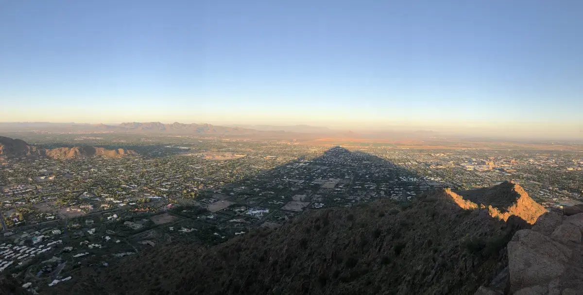
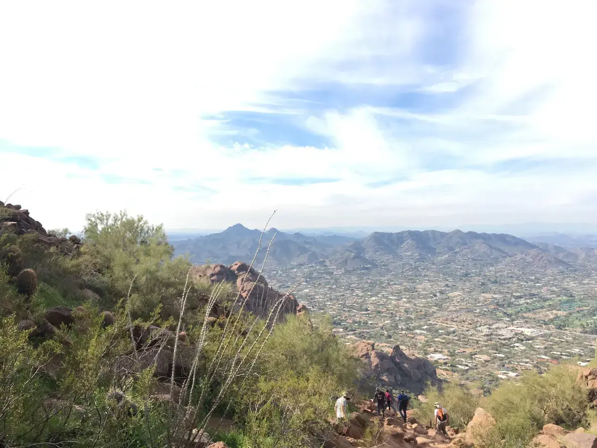
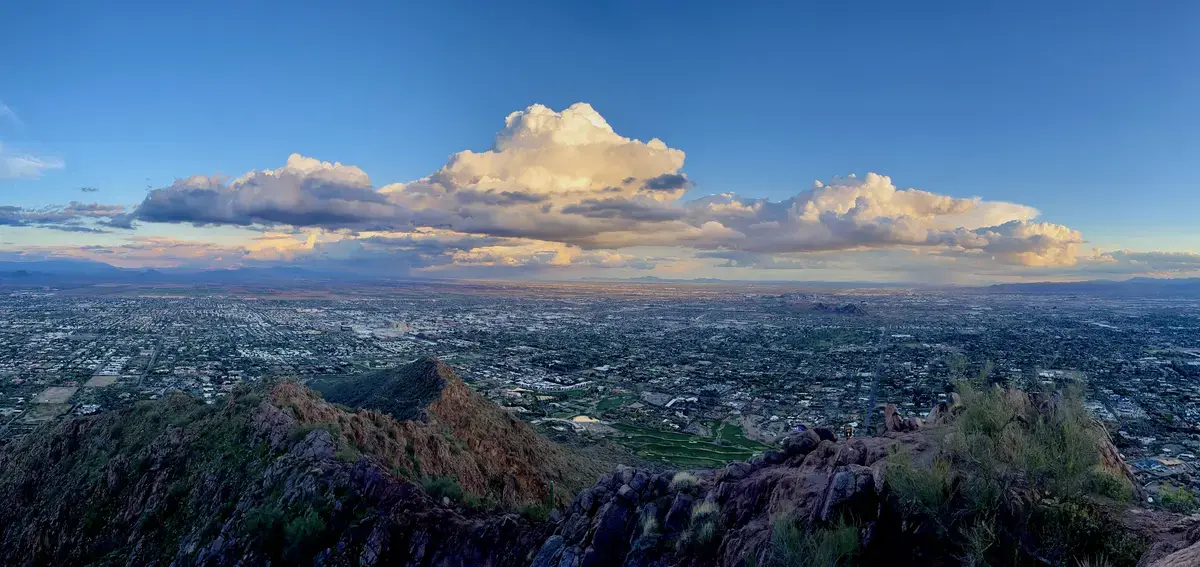
The summit itself is two peaks. The views are genuine. On a clear winter morning you can see the full spread of the Valley below, the other mountain ranges in every direction, and a sheer drop off the north face that is worth the detour to look at.

The Crowds

The solitude score of 1 is not a mistake.

This is the most hiked mountain in Phoenix and arguably one of the most popular urban hikes in the country. On a weekend morning in February, the trail is effectively a line of people moving in both directions. You will spend portions of the ascent waiting for downhill traffic on narrow sections. The summit on a busy day has dozens of people on it at once.

The parking situation makes everything worse. The lot holds around 75 cars. It fills within 30 minutes of opening on weekends in season. Once it is full, people park on surrounding streets and walk in, adding distance in both directions. If you arrive at 8am on a Saturday in January expecting to just pull in and hike, you are going to be frustrated.

The solution is simple: go very early on a weekday. The mountain at 6am on a Tuesday is a different experience. You will still see people, but you will not be hiking in a queue.

Timing and Seasons

October through April is the window. The weather is manageable, the light is good, and the views are clear. January and February are peak season, which means peak crowds.

Summer is not a casual suggestion. Phoenix Fire Department does active rescues on this mountain every hot season. The rock surfaces are exposed to direct sun all day and radiate heat for hours after sunset. If you go between May and September, start well before sunrise and be off the mountain by 8am. Carry at least two liters of water per person.

Getting There

Echo Canyon Trailhead is at the end of Echo Canyon Drive, off McDonald Drive between Phoenix and Scottsdale. Free parking, opens at sunrise. The lot fills extremely fast on weekends. If you cannot arrive before opening, consider the Cholla Trail on the east side which has slightly better parking, or plan for a street parking situation and the extra walking.

No fees, no permits, no dogs.

What to Bring

Water is the non-negotiable. Two liters minimum on a cool day, more in any warmth. Shoes with real grip , the smooth granite on the upper scrambles does not forgive poor traction. Trekking poles for the descent if your knees need them. Sunscreen always, even in winter, because the exposure is total.

The one thing most people skip that they should not: gloves in cold weather. The metal handrails are brutally cold in December and January mornings. It is a small thing that makes a real difference.

Is It Worth It

Yes, with realistic expectations. Echo Canyon is not a scenic wilderness hike. It is a physical problem set in the middle of a major city, and the summit reward is proportional to how hard you worked to get there. The 360-degree view of Phoenix from 2,677 feet, with the city spread out in every direction, genuinely delivers.

Just go on a weekday. And park before sunrise.

Weather at Trailhead

Loading conditions...
Trail Map

Route shown is approximate and for illustration only. Not for navigation.

Elevation Profile

Nearby Hikes

Camelback Mountain - Cholla Trail
1.9 mi away
Freedom Trail #302
3.0 mi away
Piestewa Peak Summit Trail #300
3.1 mi away

How It Compares

TrailDistanceElev. GainDifficultyRatingDogs
Camelback Mountain - Echo Canyon Trail2.46 mi.+1,312 ft.7/10 5.4/10No
Camelback Mountain - Cholla Trail2.96 mi.+1,690 ft.6/10 5/10No
Freedom Trail #3023.85 mi.+1,291 ft.7/10 6.4/10No
Piestewa Peak Summit Trail #3002.3 mi.+1,202 ft.6/10 5/10No

Virtual Flyover

Virtual Flyover
2.46 mi +1312 ft

Route shown is approximate and for illustration only. Not for navigation.

Frequently Asked Questions

How hard is the Echo Canyon Trail on Camelback Mountain?
Very hard. It gains 1,640 feet in just over a mile, includes sections of genuine boulder scrambling with handrails, and has almost no shade. Most fit hikers take 1.5 to 3 hours round trip. People underestimate it constantly.
Are dogs allowed on Camelback Mountain Echo Canyon Trail?
No. Dogs are not permitted on either Camelback Mountain trail. This is strictly enforced.
What time should I arrive to get parking at Echo Canyon?
Before sunrise. The lot holds around 75 vehicles and fills within the first 30 minutes of opening on weekends. Once it is full, parking on the surrounding streets requires a long walk. If you are not there at first light on a Saturday in January, have a backup plan.
Is Camelback harder than Piestewa Peak?
Most locals would say yes, but it is close. Camelback gains more elevation over a similar distance and the upper section requires genuine scrambling with large boulders. Piestewa is steeper and more jagged on the lower section but less technical near the top. Most people who have done both say Camelback is the harder day.
What is the secret cave on Echo Canyon Trail?
There is a small natural alcove around 0.8 miles from the trailhead near post 20 on the trail. It is well known among regular Camelback hikers and offers one of the few shaded spots on the route. Worth a short detour if you know where to look.
Can you hike Camelback in summer?
You can, but it is genuinely dangerous without real preparation. The trail is completely exposed, the rock holds heat aggressively, and temperatures above 110 degrees Fahrenheit are common from June through September. Phoenix Fire Department responds to heat rescues on this mountain every summer. If you go in summer, start before 5am and carry at least two liters of water per person.
What shoes should I wear on Echo Canyon Trail?
Trail runners or hiking shoes with real grip. The upper scrambling sections require confident footing on smooth rock surfaces. Street shoes and sandals are a bad idea and you will see people in them struggling. Trekking poles are useful on the descent.