All Hikes
View all Arizona hikes → PhoenixSedonaTucsonFlagstaff Grand CanyonSaguaroPetrified ForestSuperstition Wilderness

View all Utah hikes → MoabSt. GeorgeSalt Lake City ZionBryce CanyonArchesCanyonlands

View all Colorado hikes → Denver AreaColorado SpringsTelluride Rocky Mountain NPMesa VerdeBlack Canyon

View all California hikes → Eastern SierraSan DiegoBay Area Joshua TreeYosemiteDeath ValleySequoia

View all New Mexico hikes → AlbuquerqueSanta FeTaos White SandsCarlsbad CavernsSandia Mountains

About

Camelback Mountain - Cholla Trail

The longer, slightly more forgiving way up Camelback that earns the same summit and the same views, with a final third that will make you question your life choices regardless.

2.96 mi.Distance
+1,690 ft.Elevation
2.5 - 4.0 hrs.Est. time
5/10Our Rating
NoDogs
FreeFees

Our Ratings

How we rate trails

🏔️
Scenery Views, landscape variety, and visual payoff. Does the trail deliver something worth the effort?
🥾
Trail Quality Surface condition, signage, and how well-maintained the route is. A high score means you can focus on the hike instead of the logistics.
🌿
Solitude Crowd levels and the realistic chance of finding a quiet moment. One of the most honest scores we give — popular trails pay for their scenery here.
🚗
Accessibility Parking, trailhead amenities, and how easy the trail is to access for someone visiting the area for the first time.
🦅
Wildlife & Nature Flora, fauna, and ecological interest beyond the view. Trails with rich desert or alpine ecosystems score well here.

Each category rated 1–10. Overall score is the average.

🏔️ Scenery
6
🥾 Trail Quality
6
🌿 Solitude
2
🚗 Accessibility
5
🦅 Wildlife & Nature
6
Overall Score 5/10

Difficulty

How we score difficulty

Scored from elevation gain per mile and technical terrain. A trail with scrambling or route-finding gets a higher score than pure grade alone. Hard trails are not necessarily better trails.

1-2 Very Easy Flat, short, well-maintained
3-4 Moderate Some elevation, clear trail
5-6 Challenging Sustained climb, rough surface
7-8 Strenuous Steep, technical, some exposure
9-10 Extreme Scrambling, route-finding, serious commitment
6 /10
Challenging

Sustained climb, rough surface

Getting There

Cholla Trail Trailhead

Most people who hike Camelback go to Echo Canyon. They know the name, they know the parking lot, they know the handrails. The Cholla Trail comes up the other side of the mountain, from the east, through a quieter neighborhood in Scottsdale. It is not easier. It is just different, and that difference matters more than people expect.

Overview

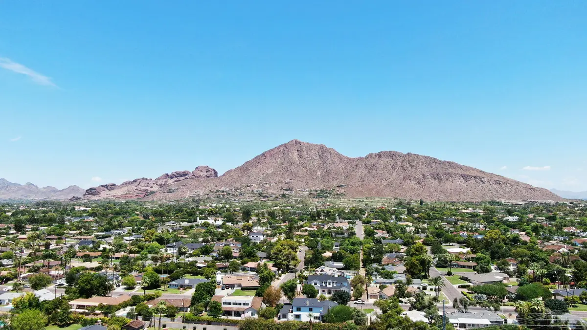
Cholla Trail ascends the eastern slope of Camelback Mountain, approaching the summit from the opposite direction of the more famous Echo Canyon route. The lower two thirds follow a well-defined path with a manageable grade. The upper third is a boulder scramble that requires hands and feet and a genuine comfort with exposure. The summit is the same 2,704 feet either way, and so are the views. This trail is for experienced hikers who want a slightly longer approach and a less crowded starting point. It is not for beginners.

Two Trails in One

The Cholla Trail has a split personality and it is worth knowing about before you go.

The lower section is genuinely pleasant. The trail is well defined, the grade is steady rather than brutal, and the saguaro and cholla cactus lining the path give it a different character than the rocky west face. You gain elevation without feeling like you are paying for every foot of it. The first mile and a half moves through this section and it goes quickly.

Then the saddle arrives. There is a small rest area here and a clear view of what is ahead. The upper third of the trail changes completely. The defined path dissolves into boulders. The grade steepens sharply. The route is difficult to follow and requires reading the terrain rather than following a line. Hands go on rock. Drop-offs appear on both sides. Shorter hikers will find some of the moves genuinely awkward given the size of the boulders involved.

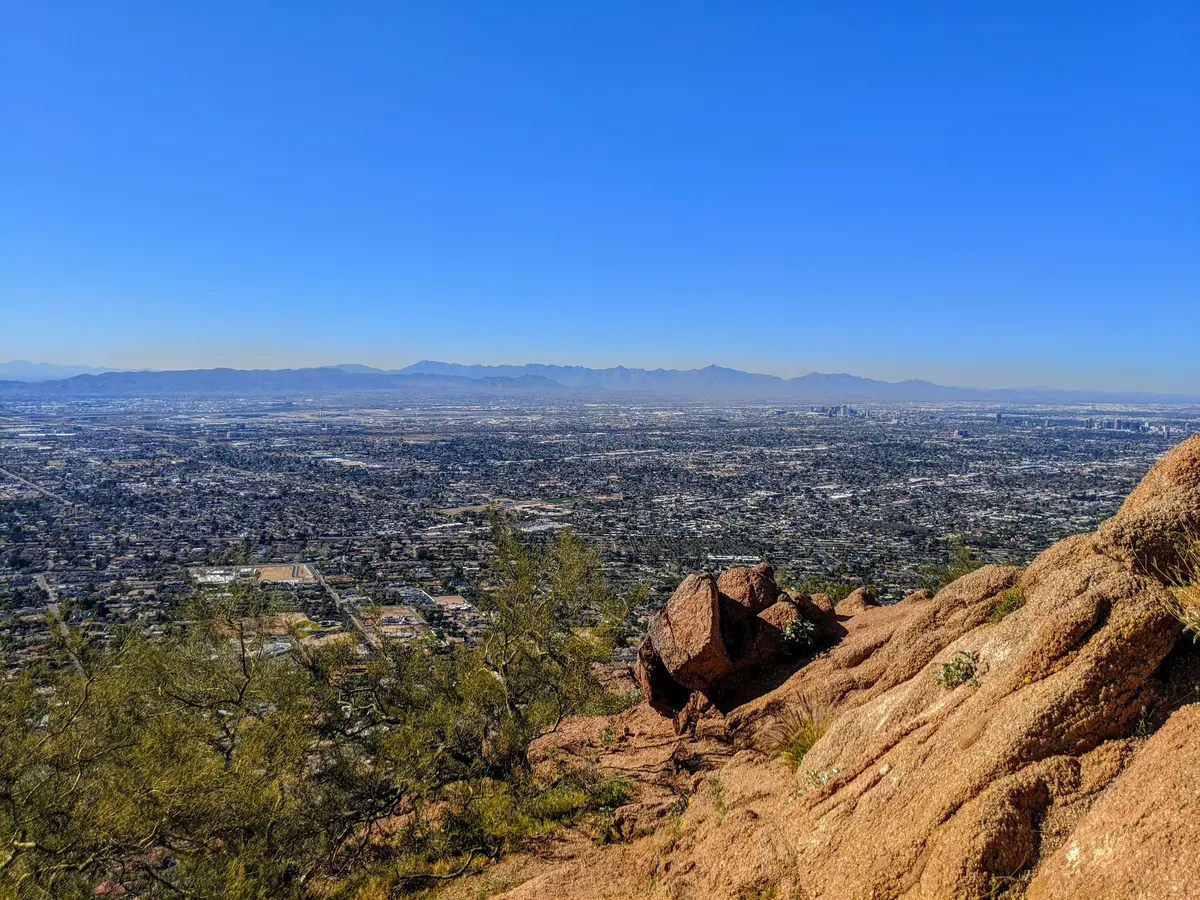
This section is where the trail earns its extremely difficult rating. It is also where the views open up fully, looking back east over Scottsdale and north toward the McDowell Mountains. The summit, when you reach it, gives you the full Phoenix spread in every direction. It is a good payoff. The work to get there is real.

The descent on the boulder section requires the same attention as the ascent and, for most people, takes longer. Loose gravel on the lower section can be slippery on the way down. Poles help if your knees need them.

Timing & Crowds

October through April. Same answer as every exposed Phoenix mountain hike. Earlier in that window is better. November and December mornings on the Cholla Trail are about as good as it gets in terms of temperature and light.

The Cholla trailhead is less chaotic than Echo Canyon but do not mistake that for low traffic. Camelback Mountain is one of the most hiked urban peaks in the country and both trails show it. The street parking situation on Invergordon Road means the crowd feels less concentrated than the Echo Canyon lot, but the trail itself gets busy on weekend mornings. Weekday visits are noticeably quieter.

Start at or before sunrise. Parking gets difficult by 8am on weekends. More importantly, the trail is completely exposed and the rock surface begins radiating heat within an hour of direct sun. An early start is not optional in any season except deep winter.

Getting There

The Cholla Trailhead is accessed from Invergordon Road in Scottsdale, east of the mountain. There is no parking lot. Parking is parallel street parking on the west side of Invergordon Road in clearly marked sections only. The restrictions are strictly enforced and towing is real. Rideshare drop-off zones are marked with yellow curbs along Cholla Lane, which leads to the trailhead via a gravel path.

There is no water at the trailhead. No fees, no permits. No dogs.

What to Bring & Safety

Two liters of water is the stated minimum and it is genuinely a minimum, not a comfortable amount. Three liters is more appropriate for a full round trip in cool weather. More in anything warmer.

Shoes with real grip are not negotiable on the upper boulder section. The rock is smooth in places and the consequences of a slip are significant. Trail runners with good traction work. Approach shoes or hiking boots with a stiff sole are better.

Rattlesnakes are regularly encountered on this trail. Watch where you put your hands on the boulder section, particularly in cracks and under ledges. The trail also passes through dense cholla cactus on the lower sections. Cholla spines detach easily and are difficult to remove. Stay on the path.

Bees have been reported as a hazard on this trail. If you encounter a swarm, move quickly and do not stop. This is not a common occurrence but it happens.

The saddle rest area is the right turnaround point if you have any doubt about the scrambling above. The views from there are real. There is no requirement to push into terrain you are not prepared for.

Weather at Trailhead

Loading conditions...
Trail Map

Route shown is approximate and for illustration only. Not for navigation.

Elevation Profile

Nearby Hikes

Camelback Mountain - Echo Canyon Trail
1.9 mi away
Freedom Trail #302
4.8 mi away
Piestewa Peak Summit Trail #300
5.0 mi away

How It Compares

TrailDistanceElev. GainDifficultyRatingDogs
Camelback Mountain - Cholla Trail2.96 mi.+1,690 ft.6/10 5/10No
Camelback Mountain - Echo Canyon Trail2.46 mi.+1,312 ft.7/10 5.4/10No
Piestewa Peak Summit Trail #3002.3 mi.+1,202 ft.6/10 5/10No
Freedom Trail #3023.85 mi.+1,291 ft.7/10 6.4/10No

Virtual Flyover

Virtual Flyover
2.96 mi +1690 ft

Route shown is approximate and for illustration only. Not for navigation.

Frequently Asked Questions

Is the Cholla Trail easier than Echo Canyon?
The lower two thirds are more gradual than Echo Canyon, which makes the early part of the hike feel more manageable. The upper third is a different story. Both trails converge near the summit and the scrambling on that final section is equally difficult regardless of which side you approach from. Most people who call Cholla easier have only done the lower portion.
Where do you park for the Cholla Trail?
There is no parking lot at Cholla Trailhead. Parking is parallel street parking on the west side of Invergordon Road in designated sections only. The restrictions are enforced and vehicles parked in violation will be towed. Rideshare drop-off zones are marked with yellow curbs. Arrive early on weekends or plan to be dropped off.
Is there water at the Cholla Trailhead?
No. There is no potable water at Cholla Trailhead. Bring everything you need from wherever you are coming from. This is not a trail where you can top off at the start.
Are dogs allowed on the Cholla Trail?
No. Dogs are not permitted on either Camelback Mountain trail.
Can you hike the Cholla Trail in summer?
The trail is completely exposed from start to finish and the rock surface holds heat for hours. Phoenix Fire Department responds to heat rescues on Camelback every summer. If you go between May and September, start well before sunrise and have a plan to be off the mountain before 8am. Most people should not attempt this trail in summer at all.
Where do most people turn around on the Cholla Trail?
There is a small rest area at the saddle just before the boulder section begins. This is the natural turnaround point for hikers who are not comfortable with the scrambling above. The views from the saddle are already good and the decision to stop there is a reasonable one.
Is there a way to connect Cholla and Echo Canyon into a loop?
Yes. Some hikers ascend Cholla and descend Echo Canyon, or vice versa, by arranging a vehicle shuttle between the two trailheads. The trailheads are on opposite sides of the mountain and about a fifteen minute drive apart. The summit connects both trails.