All Hikes
View all Arizona hikes → PhoenixSedonaTucsonFlagstaff Grand CanyonSaguaroPetrified ForestSuperstition Wilderness

View all Utah hikes → MoabSt. GeorgeSalt Lake City ZionBryce CanyonArchesCanyonlands

View all Colorado hikes → Denver AreaColorado SpringsTelluride Rocky Mountain NPMesa VerdeBlack Canyon

View all California hikes → Eastern SierraSan DiegoBay Area Joshua TreeYosemiteDeath ValleySequoia

View all New Mexico hikes → AlbuquerqueSanta FeTaos White SandsCarlsbad CavernsSandia Mountains

About

Freedom Trail #302

A rugged loop around Piestewa Peak that earns its views without the summit circus — the smarter choice when the #300 lot is already full.

3.85 mi.Distance
+1,291 ft.Elevation
3.0 - 4.0 hrs.Est. time
6.4/10Our Rating
NoDogs
FreeFees

Our Ratings

How we rate trails

🏔️
Scenery Views, landscape variety, and visual payoff. Does the trail deliver something worth the effort?
🥾
Trail Quality Surface condition, signage, and how well-maintained the route is. A high score means you can focus on the hike instead of the logistics.
🌿
Solitude Crowd levels and the realistic chance of finding a quiet moment. One of the most honest scores we give — popular trails pay for their scenery here.
🚗
Accessibility Parking, trailhead amenities, and how easy the trail is to access for someone visiting the area for the first time.
🦅
Wildlife & Nature Flora, fauna, and ecological interest beyond the view. Trails with rich desert or alpine ecosystems score well here.

Each category rated 1–10. Overall score is the average.

🏔️ Scenery
7
🥾 Trail Quality
8
🌿 Solitude
5
🚗 Accessibility
7
🦅 Wildlife & Nature
5
Overall Score 6.4/10

Difficulty

How we score difficulty

Scored from elevation gain per mile and technical terrain. A trail with scrambling or route-finding gets a higher score than pure grade alone. Hard trails are not necessarily better trails.

1-2 Very Easy Flat, short, well-maintained
3-4 Moderate Some elevation, clear trail
5-6 Challenging Sustained climb, rough surface
7-8 Strenuous Steep, technical, some exposure
9-10 Extreme Scrambling, route-finding, serious commitment
7 /10
Strenuous

Steep, technical, some exposure

Getting There

Freedom Trail #302 Trailhead

Everyone who hikes in Phoenix eventually ends up at Piestewa Peak. Most of them go straight for the Summit Trail (#300), join the queue, and spend the morning shuffling uphill with several hundred of their closest strangers. A smaller, smarter group goes left out of the parking lot and disappears onto the Freedom Trail. This is a review for that group.

Overview

Freedom Trail #302 is a loop that circles the entire perimeter of Piestewa Peak — 3.6 miles, roughly a thousand feet of gain, no summit required. It is the trail you do when you want a real workout in the Phoenix Mountains without the circus that comes with the #300. The views are genuinely good, the trail is well-maintained, and the crowd level is meaningfully lower than its famous neighbor. It is not easy, but it is one of the more rewarding loops in the preserve for anyone willing to put in the effort.

The Trail

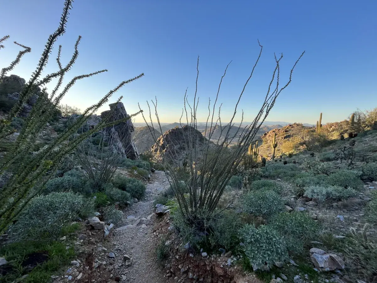
The loop runs counterclockwise out of the main trailhead, and the two halves have very different personalities. The east side opens gently — a gradual climb along the base of the peak, good sightlines, partially shaded in the early morning. It lulls you into a rhythm. Then at around mile 1.3 the trail kicks hard, gaining nearly 400 feet in half a mile with grades touching thirty percent in places. It is not technical but it is relentless, and the loose rock underfoot means you are working harder than the grade alone would suggest.

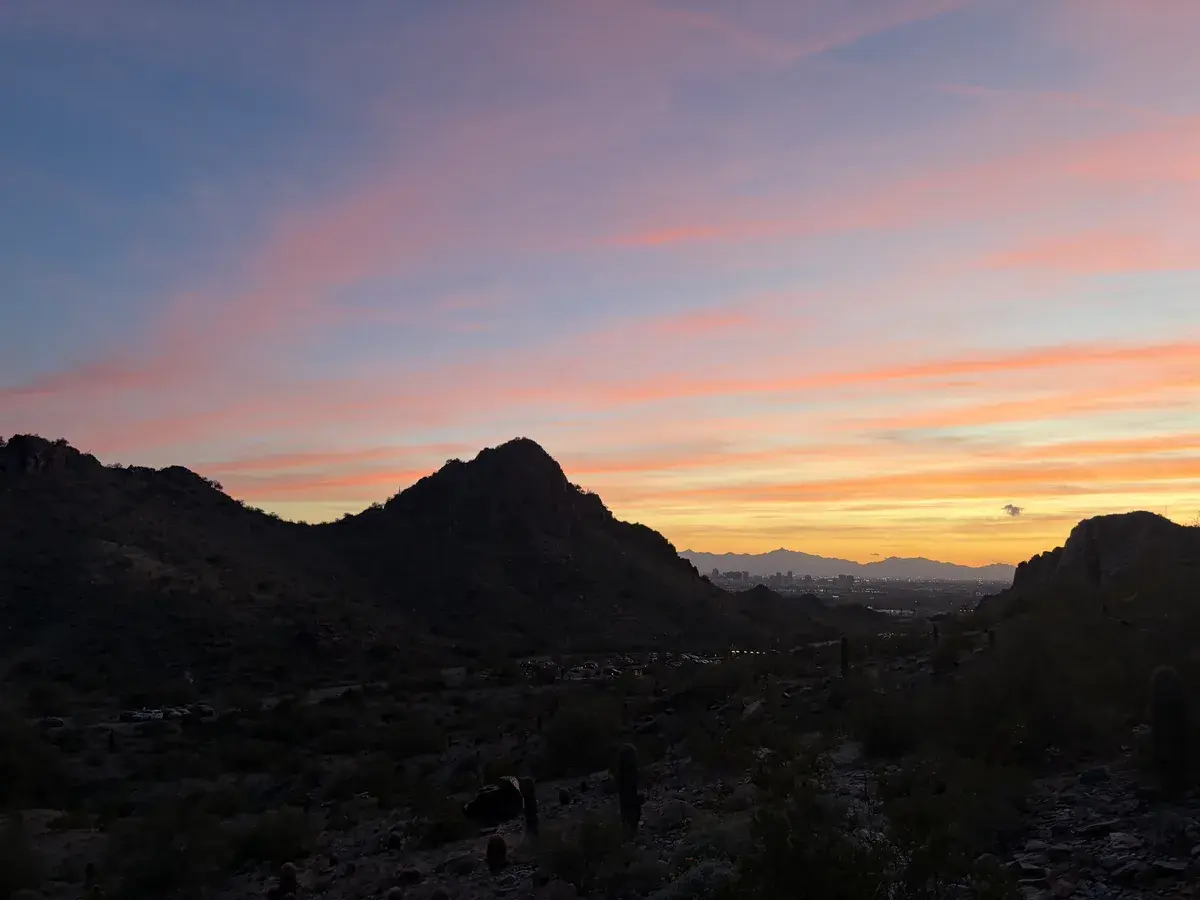
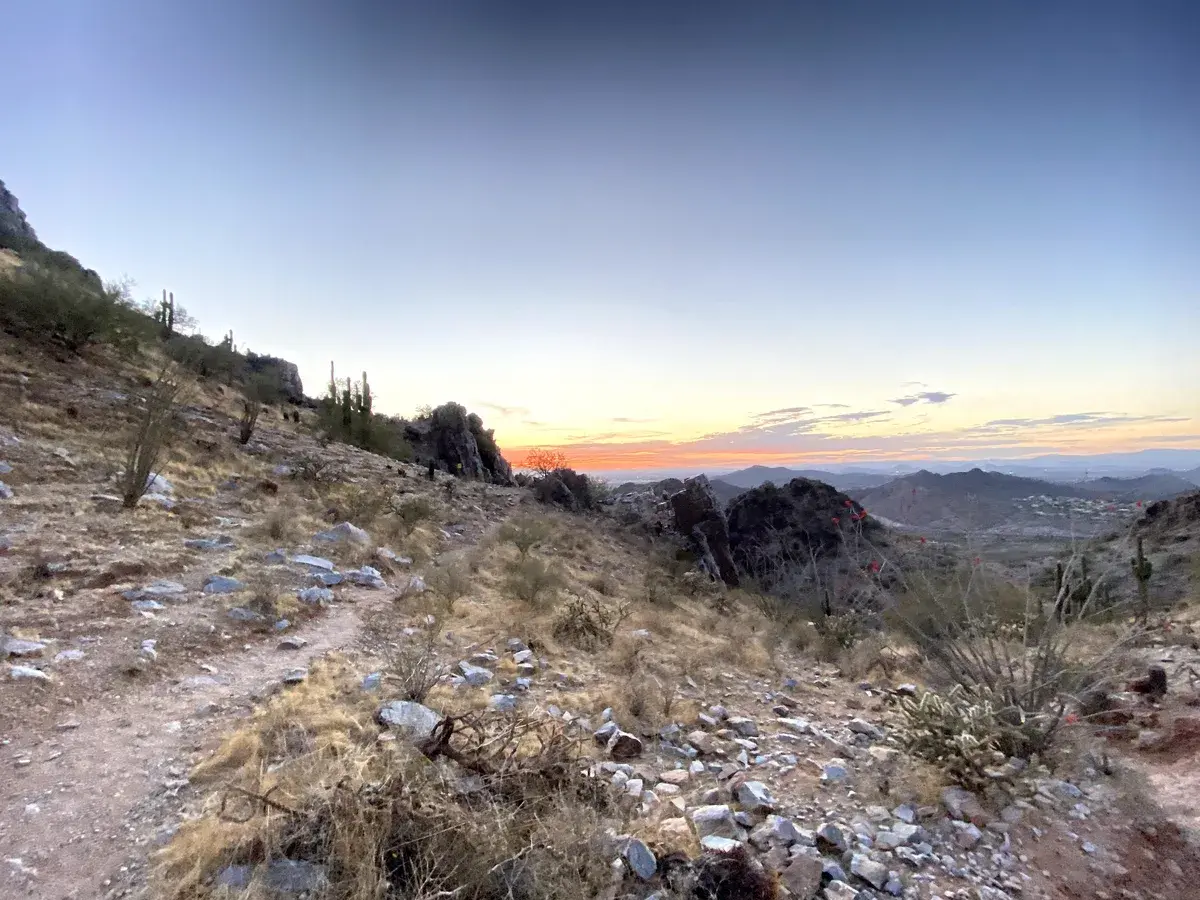
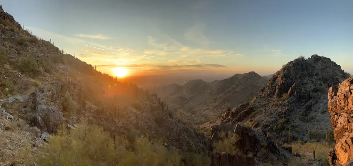
The west side is rockier and more navigationally demanding. Several social trails intersect with the #302 on the backside of the peak and the signage is not always obvious. Pay attention to the markers. The descent here drops around 550 feet gradually before flattening out briefly, then the trail hits its second big climb — a shared stretch with the Summit Trail, rock stairs with twelve to eighteen inch steps, 400 feet in four-tenths of a mile. At the top you have the option to tag the Piestewa Peak summit or peel off back to the trailhead. The #302 peels off. The views from this high point looking northwest over the city are the best on the loop.

The trail surface is rocky and uneven throughout. Not dangerous, but demanding of your attention the entire time. You will not be admiring the view while also watching your feet — you have to pick one.

Timing & Crowds

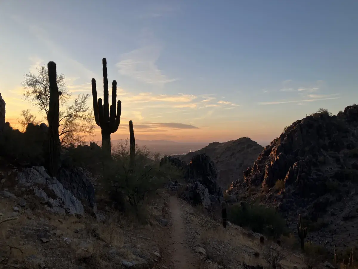
October through April is the window. The trail has almost no shade and the desert surface radiates heat aggressively, which makes summer genuinely dangerous without a pre-dawn start. In the cooler months, early morning is still the right call — the light on the rock faces in the first hour is good, and you will beat the worst of the weekend crowd.

The #302 is noticeably less crowded than the Summit Trail but do not mistake that for quiet. The Phoenix Mountain Preserve does not really do quiet on weekends. On a weekday morning in November you can go long stretches without seeing anyone. On a Saturday in February you will share the trail, just not as desperately as the #300 situation.

Spring is worth calling out specifically. The wildflower blooms across the preserve in March and April turn this loop from a solid workout into something genuinely beautiful.

Getting There

The Piestewa Peak Park entrance is on Piestewa Peak Drive in Phoenix, which feeds off Lincoln Drive between 24th Street and Squaw Peak Drive. The first parking lot is shared with the Summit Trail and fills fast on weekends — within the first thirty minutes of opening in peak season. If that lot is full, additional lots further up the road connect to the Freedom Trail with a short walk. Restrooms and water are available at the trailhead.

No fees, no permits. No dogs on the technical sections shared with the Summit Trail — those stretches are clearly signed.

What to Bring & Safety

Water is the priority. The trail is fully exposed for most of its length and the rocky surface holds heat for hours after the sun hits it. Two liters minimum on a cool day, three in anything warmer. Electrolytes are not overkill here.

Shoes with real grip matter on this trail. The rocks are well-worn and slick in multiple sections, and wet conditions make several of the steeper stretches genuinely hazardous. Avoid this trail if rain is in the forecast or has fallen recently. Trekking poles help on the west side descent if your knees appreciate the support.

Sunscreen regardless of season. The exposure is total from about thirty minutes into the hike until you are back at the trailhead.

Weather at Trailhead

Loading conditions...
Trail Map

Route shown is approximate and for illustration only. Not for navigation.

Elevation Profile

Nearby Hikes

Piestewa Peak Summit Trail #300
0.3 mi away
Camelback Mountain - Echo Canyon Trail
3.0 mi away
Camelback Mountain - Cholla Trail
4.8 mi away

How It Compares

TrailDistanceElev. GainDifficultyRatingDogs
Freedom Trail #3023.85 mi.+1,291 ft.7/10 6.4/10No
Camelback Mountain - Echo Canyon Trail2.46 mi.+1,312 ft.7/10 5.4/10No
Camelback Mountain - Cholla Trail2.96 mi.+1,690 ft.6/10 5/10No
Piestewa Peak Summit Trail #3002.3 mi.+1,202 ft.6/10 5/10No

Virtual Flyover

Virtual Flyover
3.85 mi +1291 ft

Route shown is approximate and for illustration only. Not for navigation.

Frequently Asked Questions

Is Freedom Trail #302 a loop?
Yes, it is a full loop around the perimeter of Piestewa Peak, roughly 3.6 miles. You can run it clockwise or counterclockwise and end up back at the same trailhead.
Can you connect Freedom Trail to the Piestewa Peak Summit?
Yes. The #302 shares a short section with the Summit Trail (#300) on the west side of the peak. Many hikers use this connection to tag the summit and then finish the loop. It adds real elevation and difficulty to the day.
Are dogs allowed on Freedom Trail #302?
Partially. The Phoenix Mountain Preserve itself is dog-friendly on leash, but the sections of #302 that share trail with the Summit Trail are not. Those sections are clearly signed. If you have a dog, check the trail map before you go.
How hard is Freedom Trail #302?
Harder than it looks on paper. It is a loop, not a summit push, but there are two significant climbs — one on the east side and one on the west — each gaining several hundred feet in a short distance. The trail is rocky and uneven throughout. Plan for two to two and a half hours.
When is the best time to hike Freedom Trail?
Early morning, October through April. The trail has almost no shade and the rocky surface holds heat aggressively. In summer this is a before-sunrise situation. In peak season the parking lot fills within the first thirty minutes of opening.
Is the parking situation as bad as Piestewa Peak?
The first lot, which is shared with the Summit Trail, fills just as fast. There are additional lots further up Piestewa Peak Drive with access to the Freedom Trail, which gives you a small advantage over the #300 crowd.